
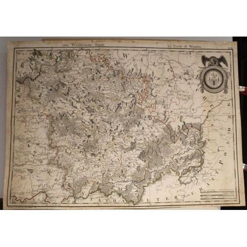
WENDEN LATVIA 1796 MELLIN UNUSUAL LARGE ANTIQUE ORIIGNAL COPPER ENGRAVED MAP
ANTIQUE ORIGINAL COOPER ENGRAVED MAP OF WENDEN LATVIA
Condition:
--not specified
Ended:
Oct 28, 2023 22:11:36 PDT
Winning bid:
US $316.69
WENDEN LATVIA 1796 MELLIN UNUSUAL LARGE ANTIQUE ORIIGNAL COPPER ENGRAVED MAP
Description
Der Wendensche Kreis. ==== Le Cercle de Wenden.
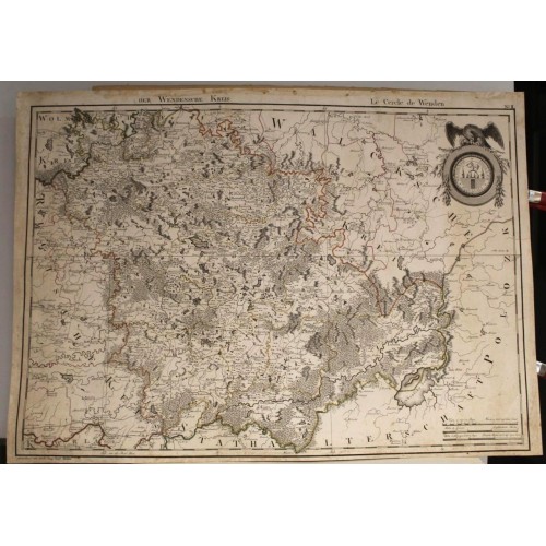
Description: Striking and highly detailed fine unusual large format 1796 Ludwig August von Mellin's copper engraved map of the area around Wenden, Latvia. The map notes cities, towns, roads, rivers, lakes, woods, mashes, hills and islands. Three mileage scales and a large Armorial adorns the sheet.
Source: Ludwig August von Mellin. Atlas von Liefland, oder von den beyden Gouvernementern u. Herzogthьmern Lief- und Ehstland, und der Provinz Oesel: entworfen nach geometrischen Vermessungen, den neusten astronomischen Beobachtungen und nach sorgfaeltiger Untersuchung und Kentnis der Gegenden: das Ganze besteht aus einer Generalkarte und vierzehn Kreiskarten = Atlas de la Livonie ou des deux Gouvernemens et Duchйs de Livonie et d'Esthonie, avec la Province d'Oesel: composй d'aprйs quantitй d'arpentages d'aprйs la connaissance des lieux mкmes, et les derniйrs observations astronomiques: contenant une carte gйnйrale et quatorze Cartes Speciales …. Riga: Johann Friedrich Hartknoch, [1798].
Date: 1796 ( undated )
Dimension: Paper size approx.: cm 73,1 x 52,9
Condition: Very strong and dark impression on good paper. paper with chains. Map old original colored. Short margins. Small foxing and browning. Small waterstains. Tears affecting the map restored. Map washed and restored. Map folded. Conditions are as you can see in the images.
Mapmaker: Count Ludwig August Mellin (23 January 1754 in Tuhala, Governorate of Reval – 12 March 1835 in Riga, Governorate of Livonia) was a Baltic German politician, cartographer, writer and publicist. He is best known for creating the first professional atlas visualizing Livonia (area now divided between Estonia and Latvia), the Atlas von Liefland, oder von den beyden Gouvernementern u. Herzogthьmern Lief- und Ehstland, und der Provinz Oesel in 1798.
He was born in Tuhala, Estonia. He visited Riga in 1782. Mellin, a soldier in the Imperial Russian Army, became a cartographer at the request of Paul I of Russia, who wanted to see a map of Livonia. Since a professional map did not exist, Mellin was put in charge of creating it. In 1798, the Atlas von Liefland, oder von den beyden Gouvernementern u. Herzogthьmern Lief- und Ehstland, und der Provinz Oesel, was published by Mellin. It took 28 years to complete it. Mellin used maps from private collections, the military, and the Russian Academy of Sciences. The map shows natural features such as islands, geology and shorelines of the region. The maps were so popular they were sold overseas. At one point, Mellin was accused of espionage because of where the maps were being sold. He was arrested. Paul I had the maps pulled off the market.
Johann Friedrich Hartknoch (Lat. Johans Frīdrihs Hartknohs) (18 September 1740 Goіdap, East Prussia – 1 April 1789 Riga) was a Latvian harpsichordist and publisher. Hartknoch, who received a musical education from his father, worked in Kцnigsberg after getting acquainted with the publishing industry from 1761 as a teacher of the young Johann Friedrich Reichardt. Two years later, he founded a publishing house in Mitau (now Jelgava) with a branch in Riga. Since then, the Riga branch was made the main office of the publishing house and, in addition to literature, music was also published. After the death of Johann Friedrich Hartknoch, the publishing house was continued by his son of the same name (1768–1819).
Hartknoch published the literary output of, among others, the following famous people: Johann Gottfried von Herder - who was a close friend of Hartknoch -, Immanuel Kant, Nikolai Karamzin, free lord Adolph Knigge, Mikhail Lomonosov and Empress Catherine II of Russia. As a music publisher, Hartknoch's main focus was on the Mannheim school and the composition production of Carl Philipp Emanuel, Johann Christian and Johann Christoph Friedrich, Johann Sebastian Bach's sons, and Johann Gottfried Mьtheli, who was part of their close circle, as well as his former student Reichardt. Between 1767 and 1797, the Hartknoch publishing house published a total of 35 titles of music, all of which, however, were printed in Leipzig.
Большая Антикварная карта Цесиса Вендена Латвия 1798 года
Высокодетализированна я изящная необычная карта большого формата, оттиск с медной платины, карта местности вокруг Цесиса (Вендена), Латвия, выполена картографом Людвигом Августом фон Меллином (Ludwig August von Mellin), 1798 год, . На карте отмечены города, поселки, дороги, реки, озера, леса, болота, холмы и острова.
Граф Людвиг Август Меллин балтийский немецкий политик, картограф, писатель и публицист. Известен созданием первого профессионального атласа Ливонии ), Atlas von Liefland, oder von den beyden Gouvernementern u. Herzogthьmern Lief- und Ehstland, und der Provinz Oesel в 1798 году.
Для составления атласа Меллин использовал карты из частных собраний, военных ведомств и Российской академии наук.
Карты были настолько популярны, что их продавали за границу. В какой-то момент Меллина обвинили в шпионаже. Он был арестован. Павел I приказал прекратить продажи его карт.
Источник: Ludwig August von Mellin. Atlas von Liefland, oder von den beyden Gouvernementern u. Herzogthьmern Lief- und Ehstland, und der Provinz Oesel: entworfen nach geometrischen Vermessungen, den neusten astronomischen Beobachtungen und nach sorgfaeltiger Untersuchung und Kentnis der Gegenden: das Ganze besteht aus einer Generalkarte und vierzehn Kreiskarten = Atlas de la Livonie ou des deux Gouvernemens et Duchйs de Livonie et d'Esthonie, avec la Province d'Oesel: composй d'aprйs quantitй d'arpentages d'aprйs la connaissance des lieux mкmes, et les derniйrs observations astronomiques: contenant une carte gйnйrale et quatorze Cartes Speciales . Riga: Johann Friedrich Hartknoch, [1798].
1798 ( недатированная)
Размер листа: cm 73, 1 x 52, 9
Очень сильный и темный оттиск на плотной бумаге верже. Ручная акварельная раскраска эпохи. Карта старая оригинальная цветная. Узкие поля. Мелкий фоксинг. Небольшие пятна от воды. Разрывы, влияющие на карту, восстановлены. Карта отмыта и восстановлена. Карта в сложенном виде. Состояние на фото.
Пожалуйста, пишите сообщения, не всегда могу ответить по телефону.
https://www.ss.lv/msg/ru/home-stuff/canvas-antiques/canvas/UnkJHU9iSF4=.html?1698873865
4754
- Product Code: 4754
- Availability: In Stock
-
$0.00
- Ex Tax: $0.00