
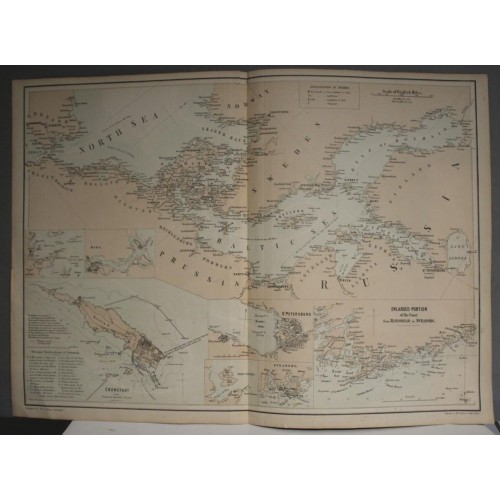
BALTIC SEA NORTH SEA 1860ca BLACK/SCHENCK & MCFARLANE UNUSUAL ANTIQUE MAP
ANTIQUE LITHOGRAPHIC MAP OF THE BALTIC & NORTH SEAS
BALTIC SEA NORTH SEA 1860ca BLACK/SCHENCK & MCFARLANE UNUSUAL ANTIQUE MAP
Description
Untitled.
Description: Striking and highly detailed fine unusual original colored lithographic map focused on the Baltic Region, which was included in A&C Black's General Atlas, although the map itself was lithographed by Schenck & McFarlane in Edinburgh. Large inset plans of St. Petersburg, Sveaborg, Port Galtic, Reval, Riga, Port Baltic and the coast from Hangohead to Sveaborg.
Date: 1860 approx. ( undated )
Dimension: Paper size approx.: cm 61,6 x 44,1
Condition: Very strong and dark impression on good paper. Plate old original colored. Quite margins. Corners partially missing. Small foxing and browning. Small tears. Map folded. Conditions are as you can see in the images.
Publishers: Charles and Adam Black (fl. 1807 - present) were map and book publishers based in Edinburgh. Charles and his uncle, Adam, both of Edinburgh, Scotland, founded their publishing firm in 1807. They published a series of maps and atlases throughout the 19th century. In addition to an array of atlases, the Black firm is known for their editions of the Encyclopedia Britannica (1817 - 1826) and the first publishing of Sir Walter Scott's novels in 1854. In 1889 the A. & C. Black publishing house moved to London where it remains in operation to this day.
Schenck & McFarlane (1850-1871 fl.) has been a Lithographic printer/publisher firm set up by Emil Ernst Friedrich Schenck (1811-1885) and William Husband MacFarlane (q.v.) in 1850; the partnership was dissolved in 1859 but McFarlane continued to trade under this name until 1871.
10282
- Product Code: 10282
- Availability: In Stock
-
$0.00
- Ex Tax: $0.00