
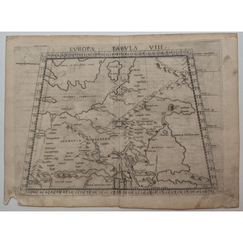
Europae Tabula VIII.
Maker: RUSCELLI, G.
Date: Venice, 1561
Size: 190 x 245 mm / 7.5 x 9.6 inches
Condition: One hole on lower margin. Very good and dark impression. With Italian text on verso.
Ptolemaic map of eastern Europe, including a portion of Scandinavia, Poland, Lithuania, Ukraine and Russia, stretching from the Swedish island of Gotland (Gothia Insula) to the Black Sea.
This edition was printed in Venice by Vincente Valgrisio, and edited by Girolamo Ruscelli, with the maps engraved by Giulio Sanuto.
Girolamo Ruscelli's edition of Ptolemy's Geographia included newly engraved copperplates by Giulio and Livio Sanuto. The curious fact is that this map is one of two that were engraved on the same plate, printed and than separated for the book. This can be seen in the atlas by the fact that the plate mark of the map runs off the top of the page. In 1574 a new plate was used which lasted until the final edition of 1599.
1997
- Product Code: 1997
- Availability: In Stock
-
$0.00
- Ex Tax: $0.00