
LIST ON EBAY
Между листами оргалита
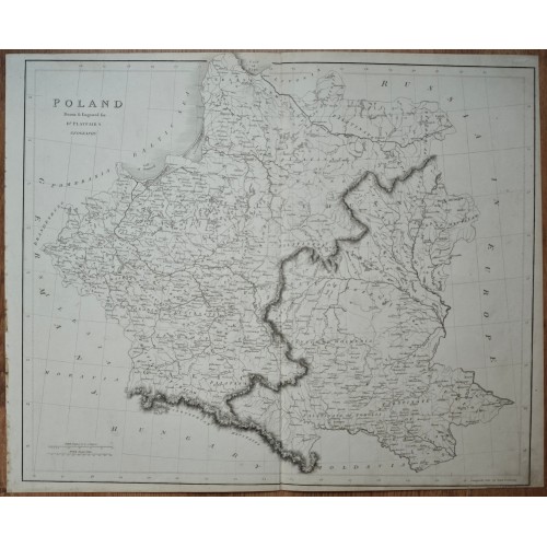
Antique 1824 Map of Poland & Lithuania by James Playfair
This is an authentic, large-scale antique copper-plate engraved map of Poland, specifically created and engraved for Dr. James Playfair’s "A New General Atlas, Ancient and Modern." Published circa 1824, this map provides a detailed geographical and political overview of the region following the historic partitions of the late 18th century.
The map depicts the territories of the former Polish-Lithuanian Commonwealth. Heavy, dark engraved lines clearly delineate the borders between the territories seized by the Russian Empire, Kingdom of Prussia, and Austrian Empire. It serves as a significant historical record of Central and Eastern Europe during the Napoleonic and post-Congress of Vienna eras.
Cartographer: James Playfair (1738–1819)
Publication Date: c. 1824
Region: Poland, Lithuania, parts of modern-day Ukraine, Belarus, and Germany.
Detailed topography showing mountain ranges (hachured), river systems, and major cities including Warsaw, Krakow, Vilnius (Wilna), and Danzig.
Inscriptions: "POLAND. Drawn & Engraved for Dʳ Playfair's GEOGRAPHY" (Top left).
Features the original central vertical fold as issued in the atlas.
General State: [e.g., Clean and bright with minor age-toning / Slight foxing at the edges / Sharp engraving lines]. No major tears or repairs.
Dimensions:
Sheet size: approx. [insert width] x [insert height] inches.
Plate mark: approx. [insert width] x [insert height] inches.
12347
- Product Code: 12347
- Availability: In Stock
-
$0.00
- Ex Tax: $0.00