
LIST ON EBAY
32-22
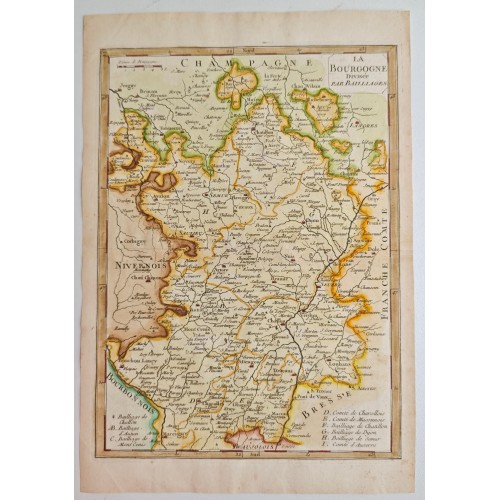
“La Bourgogne Divisee Par Bailliages”
Старинная французская карта Бургундии с делением на байяжи, выполненная в технике гравюры и раскрашенная от руки по границам. В верхней части листа помещено название, в нижней части расположена легенда с перечислением байяжей и графств. На карте показаны города, дороги, реки и границы соседних исторических областей, включая Champagne, Nivernois, Bourbonnois, Lyonnois, Bresse и Franche Comtй.
Внутри карты отмечены Dijon, Beaune, Auxerre, Autun, Semur, Chalon, Macon и другие города. Лист имеет хорошую декоративность, ясную композицию и характерный для французской картографии XVIII века рисунок. Подходит для коллекции старинных карт, кабинета, библиотеки или классического интерьера.
English version
Antique Map of Burgundy 1750 Georges-Louis Le Rouge ? Antique Engraving #12293
Antique Map of Burgundy "La Bourgogne Divisйe par Bailliages" by Georges-Louis Le Rouge (c. 1748-1757)
A copperplate engraving of the Burgundy province in France, titled "La Bourgogne Divisйe par Bailliages." This map was created by the renowned French geographer and cartographer Georges-Louis Le Rouge, who served as the "Ingйnieur Gйographe du Roi" (Geographical Engineer to the King).
The map provides a detailed administrative view of Burgundy, illustrating its division into bailliages (bailiwicks or judicial districts). It features a sophisticated level of detail for the period, including major cities such as Dijon, Autun, and Semur-en-Auxois, as well as topographical elements like rivers, forests, and mountain ranges.
Cartographer: Georges-Louis Le Rouge.
Date: 1748–1757.
Details: Includes an alphanumeric index/legend in the lower right corner identifying the different bailiwicks.
Borders: Displays neighboring historical regions such as Nivernois, Champagne, Franche-Comtй, and Bresse.
Condition: Printed on authentic laid paper with age-appropriate toning. (Note: Please specify any visible creases or spotting based on the physical item).
Dimensions:
Sheet size: 32 x 22 cm (15 x 9 inches).
Le Rouge's maps are highly regarded for their clarity and accuracy. This specific map is a significant historical document reflecting the administrative organization of pre-revolutionary France. It is an excellent piece for collectors of French history, cartography enthusiasts, or as a sophisticated decorative element.
? Pictures are part of the description and reflect the current state of the article. The real color of the item may be slightly different from the pictures shown on website caused by many factors such as brightness of your monitor and light brightness.
? Shipping: Standard domestic and international shipping. We are more than happy to combine purchases.
We ship via registered airmail with the tracking number
? Please keep in mind that shipping takes 3-4 weeks to the USA and 10-20 days to Europe.
?Please note that any returns, insurances or customs duties levied are the responsibility of the buyer. Customs can cause delays with your shipment which the seller has no control over. Please consider such delays when making your purchase.
? Returns: If you are not happy with your item, please return it to us in its original packaging within 14 days. Return shipping must be paid for by the buyer.
12293
12293
- Product Code: 12293
- Availability: In Stock
-
$0.00
- Ex Tax: $0.00